Model Courses

Related Content

Geosite
Field Guide

Mt. Amakazariyama

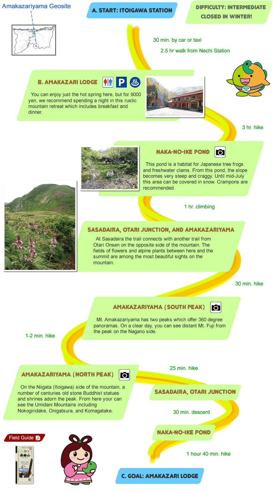
Located in Joshin'etsu Kogen National Park, Mt. Amakazariyama is one of Japan’s 100 Famous Mountains.

Geosite
Amakazariyama
Time
8 hrs
Access
Hiking (Car or Taxi for Approach)

Notice Regarding Route Information

Amakazariyama Geosite A. Start: Itoigawa Station Difficulty: Intermediate. Closed in Winter! B. Amakazari Lodge You can enjoy just the hot spring here, but for 9000 yen, we recommend spending a night in this rustic mountain retreat which includes breakfast and dinner. Naka-no-ike Pond This pond is a habitat for Japanese tree frogs and freshwater clams. From this pond, the slope becomes very steep and craggy. Until mid-July this area can be covered in snow. Crampons are recommended. Sasadaira, Otari Junction, and Amakazariyama At Sasadaira the trail connects with another trail from Otari Onsen on the opposite side of the mountain. The fields of flowers and alpine plants between here and the summit are among the most beautiful sights on the mountain. Amakazariyama (South Peak) Mt. Amakazariyama has two peaks which offer 360 degree panoramas. On a clear day, you can see distant Mt. Fuji from the peak on the Nagano side. Amakazariyama (North Peak) On the Niigata (Itoigawa) side of the mountain, a number of centuries old stone Buddhist statues and shrines adorn the peak. From here your can see the Umidani Mountains including Nokogiridake, Onigatsura, and Komagatake Sasadaira, Otari Junction Naka-no-ike Pond C. Goal: Amakazari Lodge Mt. Amakazariyama Field guide Mt. Amakazariyama Field guide
route